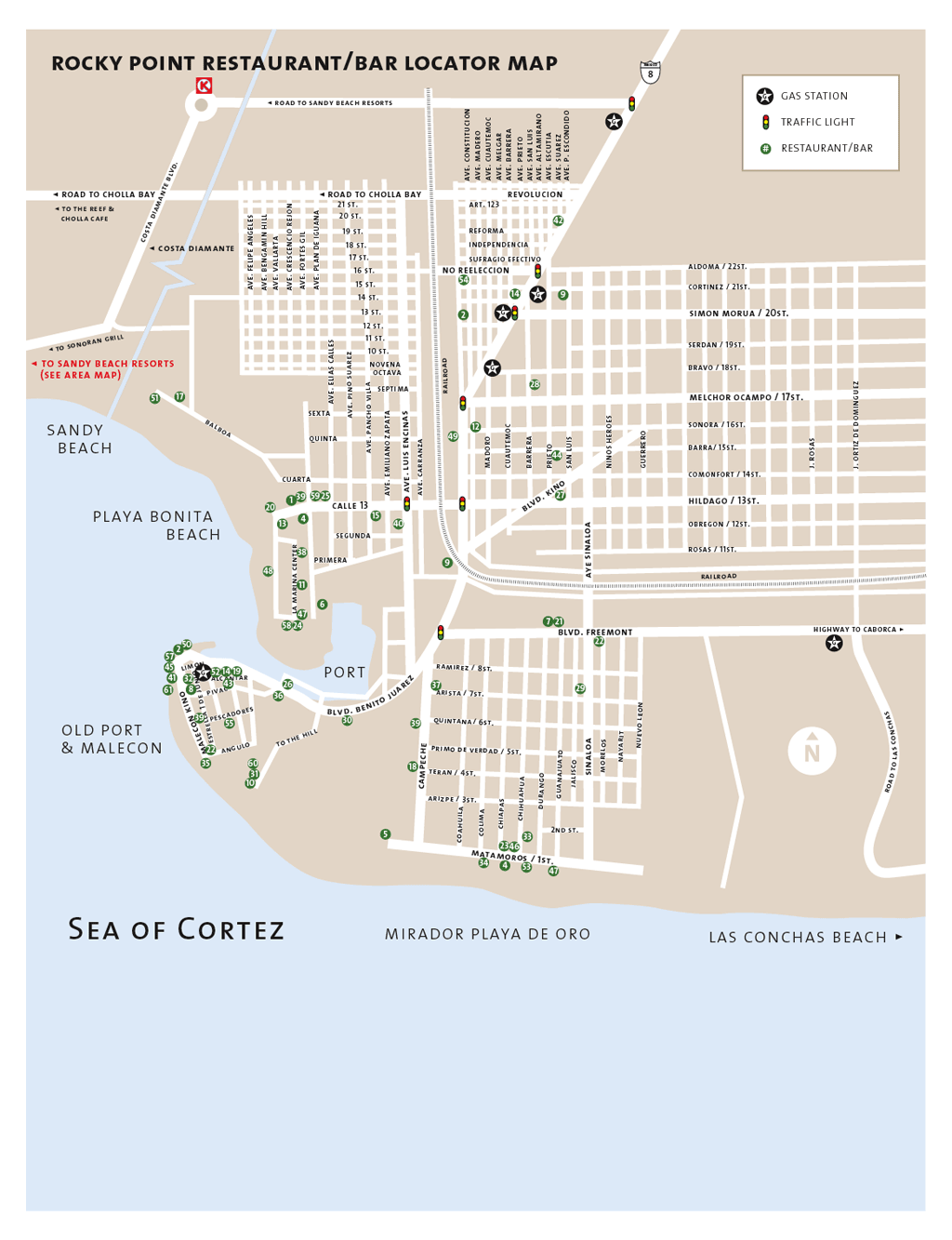
Before
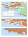
we start with directions, you can download our detailed town map which
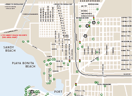
shows the location of different restaurants. We try to keep this map up
to date but businesses change constantly in Rocky Point. To download our
latest local map with restaurants and other businesses, click
here.
The detailed maps below actually provide step by step directions from
different regions of the Western United States. These are not just maps,
they also have directions. Please select the appropriate map with
directions from the list above.
We understand that directions are not always perfect. Therefore, we offer
additional driving instructions below. Please feel free to pick the
directions that you feel will get you to your destination...
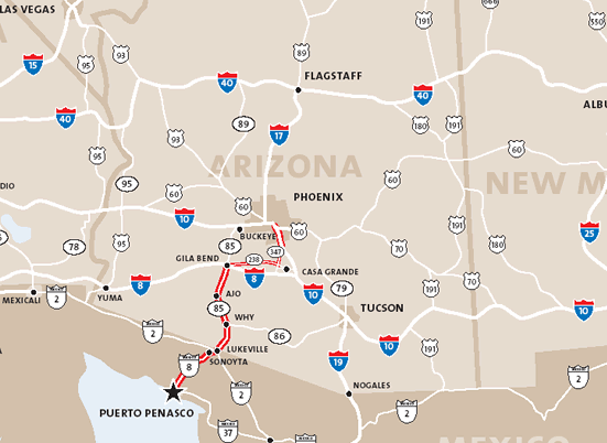
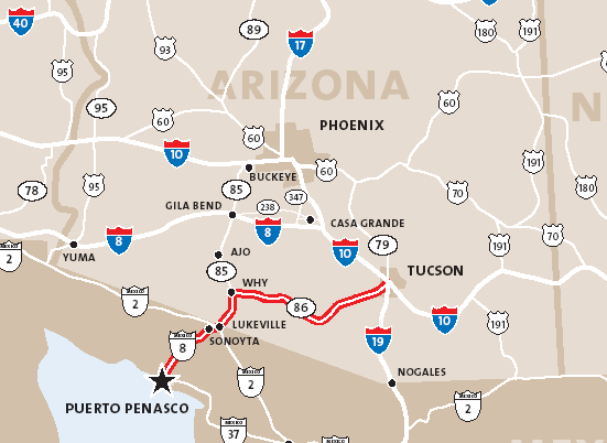
From Phoenix
Take I-10 West out of Phoenix to State
Highway 85 South. Follow 85 through Gila Bend, Ajo and Why until you reach the
Mexican Border.
Just over the U.S./Mexican border is the
Mexican town of Sonoita. Stay to the right and there are signs which direct you
through town to Puerto Penasco. Just keep a lookout for them. They will place
you on Mexico Route 8 and an almost straight run to Puerto Penasco, commonly
known as Rocky Point. There are a few sharp turns though so stay alert &
preferably drive only during the daytime.
From Tucson
Valencia Road is the largest major
street in Tucson that then becomes State Highway 86 - heading West. You can also
use Ajo Way or I-19 (Ajo Exit) - both heading West. Once on Highway 86 continue
West through Sells and Quijotoa (these towns are on the Papago Indian
Reservation - Tohono O'Odham) to the town of Why. At Why turn left onto State
Highway 85 South. Follow Highway 85 South to Lukeville, Arizona at the Mexican
Border. For information on the border crossing, see our Customs information
page.
Just over the U.S./Mexican border is the
Mexican town of Sonoita. Stay to the right and there are signs which direct you
through town to Puerto Penasco. Just keep a lookout for them. They will place
you on Mexico Route 8 and an almost straight run to Puerto Penasco, commonly
known as Rocky Point. There are a few sharp turns though so stay alert &
preferably drive only during the daytime.
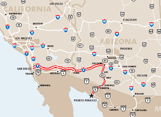
From Los Angeles
Take Interstate Highway 10 East to the
Arizona town of Buckeye, then turn south on State Highway 85 through the towns
of Gila Bend, Ajo and Why until you reach Lukeville at the Mexican border. For
information on the border crossing, see our Customs information page.
Just over the U.S./Mexican border is the
Mexican town of Sonoita. Stay to the right and there are signs which direct you
through town to Puerto Penasco. Just keep a lookout for them. They will place
you on Mexico Route 8 and an almost straight run to Puerto Penasco, commonly
known as Rocky Point. There are a few sharp turns though so stay alert &
preferably drive only during the daytime.
From San Diego
Take Interstate Highway 8 East through
the Arizona bordertown of Yuma, to the town of Gila Bend. At Gila Bend turn
south on State Highway 85 through the towns of Ajo and Why until you reach
Lukeville at the Mexican border. For information on the border crossing, see our
Customs information page.
Just over the U.S./Mexican border is the
Mexican town of Sonoita. Stay to the right and there are signs which direct you
through town to Puerto Penasco. Just keep a lookout for them. They will place
you on Mexico Route 8 and an almost straight run to Puerto Penasco, commonly
known as Rocky Point. There are a few sharp turns though so stay alert &
preferably drive only during the daytime.
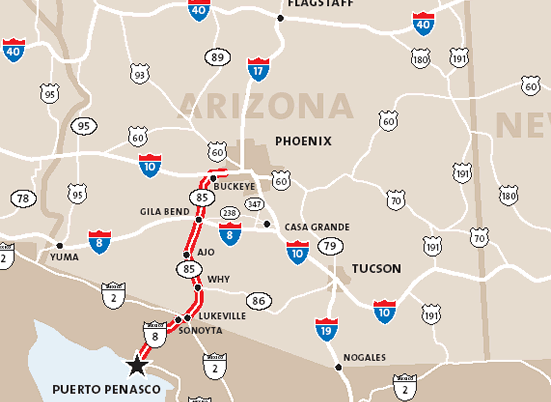
Alternate route from Yuma into Mexico
onto Peñasco
If you're coming from the west and going
through Yuma anyway, you can also cut down from Yuma, cross the border, and take
another route which involves more driving in Mexico. From Yuma, take the 95
south through Somerton to San Luis at the border. Cross into Sonora, hit the 2
and go east until you hit the 8 in Sonoyta, and then continue down to Penasco on
the 8. This route takes you around the north tip of Pinacate and through some
other volcanic/mountain formations. See
this link for a rough overview.
Travel Distances from Rocky Point:
Ajo, Az.................... 94 miles
Albuquerque,Nm.........678 miles
Caborca, Mx................108 miles
Denver, Co .................1124 miles
Farmington, Ut............. 925 miles
Guaymas, Mx...............345 miles
Hermosillo, Mx............ 270 miles
Las Vegas, Nv..............514 miles
Los Angeles, Ca...........550 miles
Lukeville, Az ................68 miles
Nogales, Mx .................294 miles
Phoenix, Az .................215 miles (Taking the 85 through Gila Bend etc.)
San Carlos,Mx..............357 miles
San Diego, Ca .............445 miles
San Francisco, Ca.......927 miles
Salt Lake City, Ut ........890 miles
Sonoyta, Mx ................66 miles
Tucson, Az .................216 miles
Yuma, Az ....................271 miles
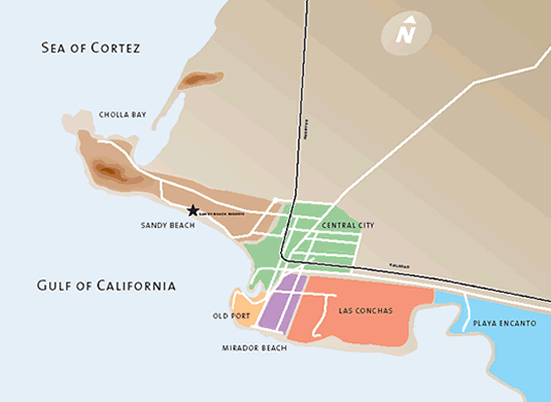
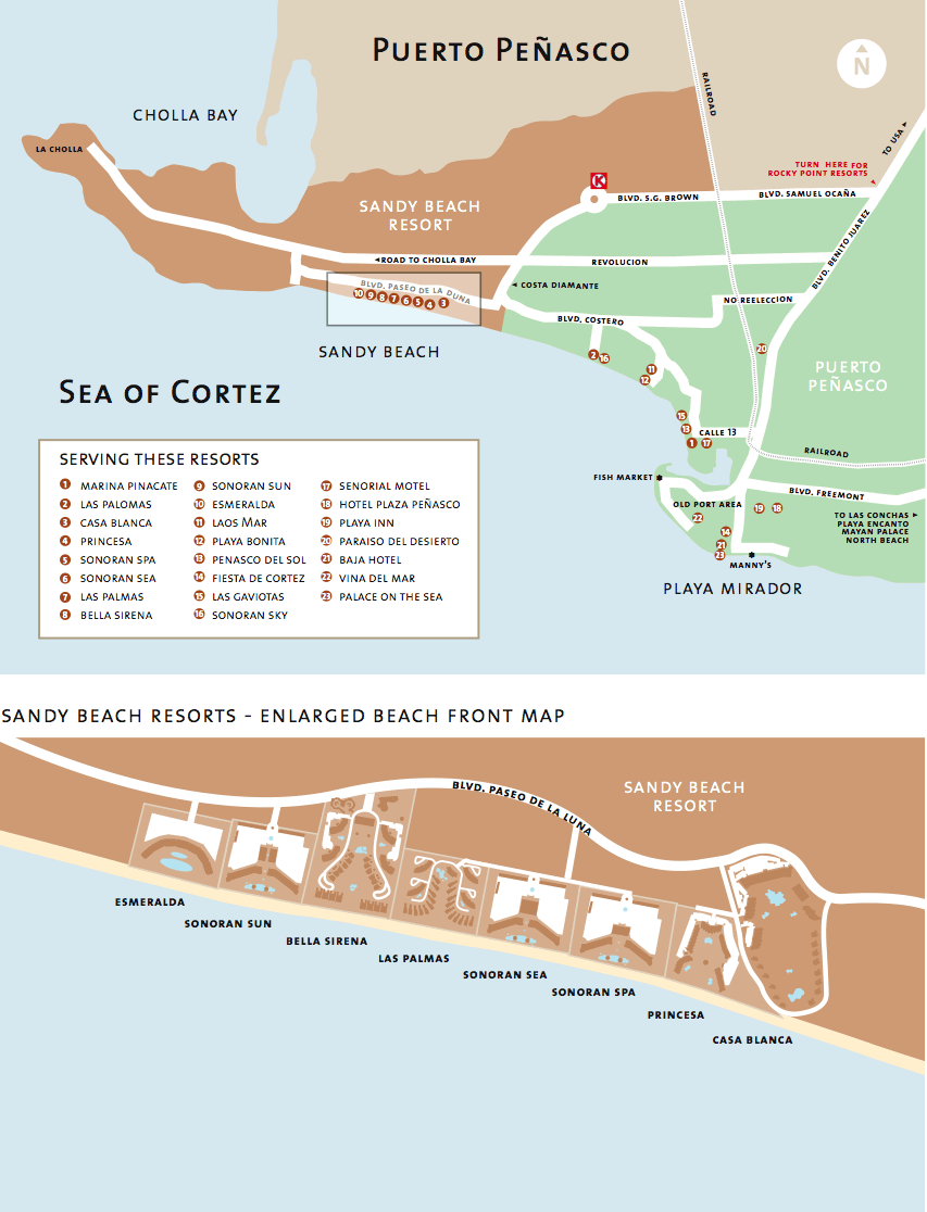
Now the fun part. Directions to each
of the resorts down in Rocky Point. We hope that we are able to cover
directions to every possible resort. You can also visit our resort map.
PDF VERSION | ENLARGED
IMAGE
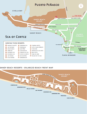
Resorts
For Bella Sirena
When you get to Rocky Point, turn right at the first stoplight. This is the
Samuel Ocaña Avenue, keep on this road past the railroad tracks, after the
railroad tracks there's no more homes, so this is an indicator you turned at the
right street, keep going past the circle K, you'll see an arch welcoming you to
Sandy Beach Resorts. Keep going down that road, past the golf course. You'll
find the Bella Sirena.
For Sonoran Sea
Just before entering Rocky Point, you will come to the first traffic light. Turn
right at the light. The street will be paved all the way to Sonoran Resorts.
Follow the circle around to the next right. Turn right and follow the road
through the arch that says "Costa Diamante". Palm trees line the road to Sonoran
Resorts. Follow the signs. When the paved road ends, turn left onto the brick
road, which leads to the entrance gate of Sonoran Spa and Sonoran Sea Resorts.
For Sonoran Sun


